- J-Marine NeCST
- Ships DX
- Smart Ship Initiatives
- Shipboard Monitoring
Handwriting on Electronic ChartsMore Efficient and Safer Operations in IoT era
- New functions have been added to J-Marine NeCST.

Handwriting on Electronic Charts
More Efficient and Optimal Route Plans
J-Marine NeCST includes a very useful input function that allows users'
handwriting on electronic charts. It also integrates meteorological and hydrographical forecasts for preparation of optimal route plans.
Moreover, electronic maps integration and prompt data sharing among ships and land will help users make more efficient and safer operations.
Optimum route display function
This function provides the optimum route that achieves the maintenance of the fuel consumption to the minimum for a planned voyage from the departing port to the arriving port that was created by J-Marine NeCST, giving the consideration to the weather and oceanographic information on the route.
This function also displays wind, wave, tide, and Typhoon information globally,
thereby improving the high-resolution weather and oceanographic information specifically for the sea near Japan.
This contributes to the energy-saving of the ship operation.
Features of J-Marine NeCST
①Handwriting
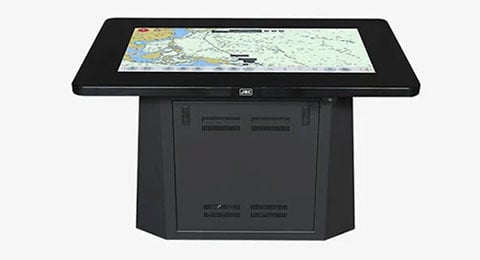
Route planning can be easily done by your finger or the
stylus touch screen pen on the touch screen panel itself.
Handwritten information on the touch screen panel,
planned and plotted routes which were stored in J-Marine NeCST can be reflected on ECDIS as well.
*Development of the above function for other ECDIS makers is in the process.*

②Improving Routine Work
Improving work efficiency on board with paperless technology.
Better visual clarity with 46 inch screen for briefing on board.

③Information Sharing with Other ships and land
The collective digitalized data from individual vessel
can be shared among vessels and land offices/stations.

④Flexible Customization
The unit is designed for the flexibility of
customization to suit individual client's needs.

J-Marine NeCST System Introduction
New Functions
What's New in J-Marine NeCST
【New】Playback Function
Reproduce navigational conditions for debriefing
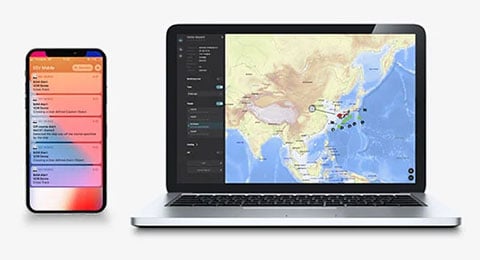
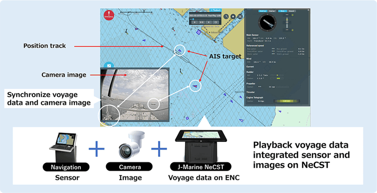
It combines camera images, sensor information and Voyage information on J-Marine NeCST (route planning, user charts etc.). It is easy to obtain the situation at the time of arrival and departure or scenes that need to be reviewed. In addition, playback data can be download and displayed from SSV which is web application enables checking at any time the status of managed ships from the management company office.
【New】Information Distribution Functions
Simultaneous transmission of information from shore to the vessels
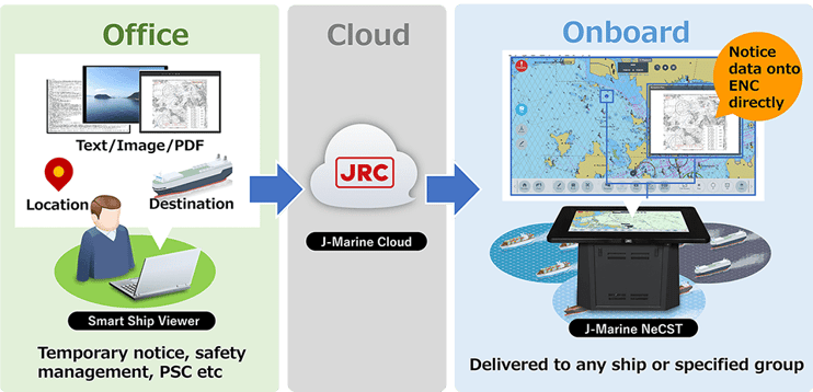
It allows land-based operators to send information to onboard J-Marine NeCST from SSV. It has made operator pushing navigational information to ENCs which are displayed on J-Marine NeCST. It provides easy shore-to-ship communication of instead of distribution by email and checking it with ECDIS. Furthermore, it also applies to playback data and allow you to share it with fleet each other.
【New】Optimum route display function
Provides optimal routes to reduce fuel consumption based on weather and sea conditions
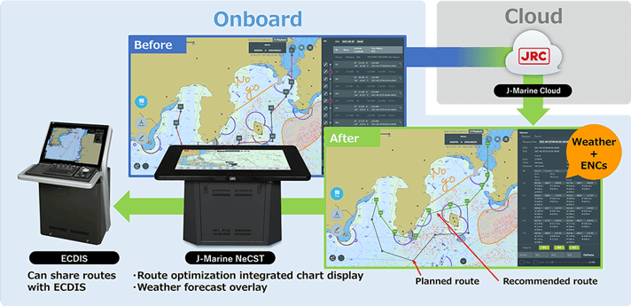
It provides recommended route calculated by weather routing. It optimizes the planned route from the aspect of weather and sea condition and fuel consumption. It also indicates high accuracy and resolution wind, waves, currents and typhoons. It adopts extremely high-quality forecast data, especially for the seas around Japan. It will contribute not only route planning made easy but also energy-saving.
Discontinued Products
Please note that some of the contents may have been changed or are no longer available.Please be aware of this in advance.
Related Products
Ships DX
Smart Ship Initiatives
