- Multilateration System(MLAT)
Monitor traffic flow in congested airfields and support air control.
Optical connection type multilateration system
- Precise position measurement by Optical connection method
- Aircraft can be monitored up to about 30NM around the airport
- International standard interface

Introduction
A multilateration system (MLAT) is a system that surveys the position of an aircraft on the airport surface. Even in situations of poor visibility from the control tower such as at night or in bad weather, the position of the aircraft can be accurately grasped, by MLAT,thus supporting safe and efficient air traffic control services. Furthermore, MLAT system can be applied not only for air traffic control, but also can serve as a sensor for surveying the vicinity of the airport. JRC's MLAT achieves positioning accuracy that exceeds the world standard. In an evaluation at an actual airport, it achieved a positioning accuracy error of 3m on the runway, compared to the standard of 7.5m (ED-117).
Introductory Video
We will introduce the multilateration system with a video.
Features
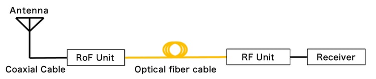
Optical fiber connection (RoF : RF over Fiber)
By means of an optical connection to the receiving stations, it has become possible to directly transmit the received signal indoors. Therefore, the signal processing functions that were previously installed outdoors can be integrated indoors.
In the existing system, it was necessary to install a large number of receiving stations in order to avoid the influence caused by a radio reflection from buildings and obstacles (multipath). However with Multilateration System, it is now possible to provide more stable position calculation with less equipment.
Furthermore, the MLAT system can reduce damage caused by lightning, water, and lightning because it does not require a power supply or LAN cable.
The mechanism of RoF is shown in the following diagram.
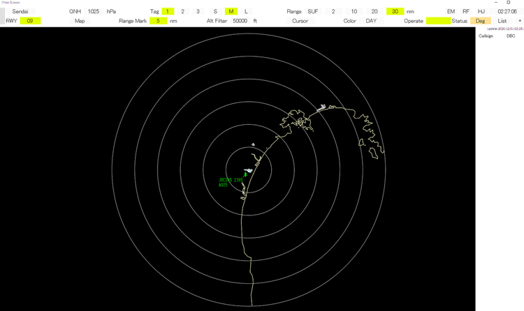
Monitoring Capability
Multilateration System is capable of monitoring aircraft (s) around 30NM from the airport. With this capability, Multilateration System is able to supervise aircraft (s) on the surface and/or surrounding airspace even in areas where TSR (Terminal Area Surveillance Radar) or SSR(Secondary Surveillance Radar) cannot be maintained.
International Standard Interface
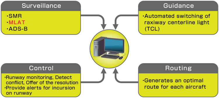
Multilateration System can be incorporated into existing systems such as Advanced - Surface Movement Guidance & Control System (A-SMGCS) and Remote Tower with the following interfaces.
Video Data : ASTERIX 10
Control / Monitor : SNMP
Expansion : ADS-B
A-SMGCS Image
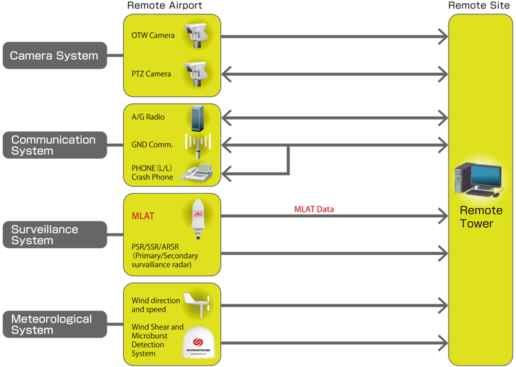
Example of combination with Remote Tower
Simple transmitter and receiving station
Maintainability is improved by making the transmitting and receiving stations a simple structure.
Especially for receiving stations, by enabling optical power supply due to saving power, maintainability is improved and life cycle cost can be reduced.
By reducing the size and weight of the receiving station, the flexibility of the installation location is improved.
Low implementation cost
Multilateration System can reduce implementation costs due to the use of a conventional facility on board the aircraft.
Functions
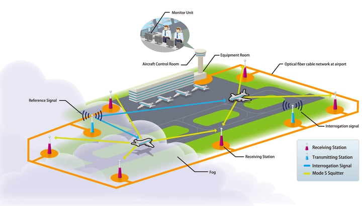
The multilateration (MLAT) system calculates the position of the aircraft using the time difference of arrival (TDOA) of the received signals from the SSR modes S, A, C, and transponders on board the aircraft.
The system consists of three or more receiving stations located around the runway and airport terminal.
Response signal from aircraft transponder is received by at least three or more receiving stations and is calculated by a hyperbolic curve based on the time difference of arrival time between them in order to detect the position of the aircraft.
In the conventional SMR (Surface Movement Radar), some areas are not able to display the position of aircraft (s) due to bad weather or shadows from buildings. On the other hand, MLAT system is able to display aircraft (s) with highly accurate position even in such situations.
System
A multilateration (MLAT) system consists of multiple receiving stations located on the ground as described above.
The number of receiving stations is determined by simulation depending upon the number of runways and the terrain of the airport.
Afterwards, the position is calculated by the signal processing unit installed indoors, and is displayed on the monitor of the control room.
The system can also send the Aircraft position information to a complex type, air route monitoring sensor processing device such as HMI (Human Machine Interface).
multilateration system Image
Specifications
| International Standard ED-117 | |||
| ASTERIX 10,SNMP correspondence | |||
| Position accuracy (Runway, Taxiway, Apron) |
Error range : within 7.5m on 95 % location information within 12m on 99% location information | ||
| Frequency | 1090 MHz (response signal), 1030 MHz (Interrogation signal) | ||
| Environment condition | outdoor | -30 ℃ ~ +60 ℃ | |
| Indoor | 0 ℃ ~ 40 ℃ | ||
| Power source | AC100 ~ 230 V | ||
Product Inquiry


Product Inquiry
