Multilateration System (MLAT)

Introduction of Implementation Customer

-Everything is for the safety of the sky -
The world's most accurate position monitoring system contributes to the safety of Vietnam's sky.

Delivery Country

Socialist Republic of Viet Nam
Vietnam Air Traffic Management (VATM)
Socialist Republic of Viet Nam

Introduced Airport

Phu Quoc International Airport

Business

Air Traffic Control

Overview of Phu Quoc International Airport

International airport in one of Vietnam's Best Resorts

Phu Quoc International Airport is located on Phu Quoc Island, Kien Giang Province, Vietnam.
It is a key point on Phu Quoc Island, which is one of Vietnam's leading resort areas and is expected to receive 5 million tourists in 2030. Due to such expected increase in tourists, it is expected that aviation demand will increase as well.

Pre-implementation Tasks

Grasp the position of the aircraft at night and in bad weather, which is difficult
image photo

Grasp the position of the aircraft at night and in bad weather, which is difficult

Before installation, controllers used binoculars to visually guide the airplane even at night and in bad weather.In air traffic control, efficient takeoff and landing on the runway is important for the operation of the airport, but at the same time, 100% safety must be guaranteed.Accurately determining the position of the aircraft for airport guidance is one of the most important information for the controller.However, at night and in bad weather, the position was determined with binoculars, relying on the slightest light of the aircraft, and it was not accurate.
To supplement this, a large amount of radio communication was carried out, and the load on the controllers remained high.

Implementation Issues and Resolution Procedures

The multilateration system that accurately informs the position of the aircraft

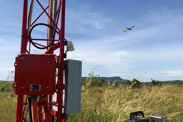
The multilateration system receives the secondary radar (SSR) signal transmitted from the aircraft by multiple receivers in the airport, then detects the precise position of the aircraft based on the time difference.
Even in situations of poor visibility from the control tower such as at night or in bad weather, the position of the aircraft can be accurately grasped by MLAT system, thus supporting safe and efficient air traffic control services.

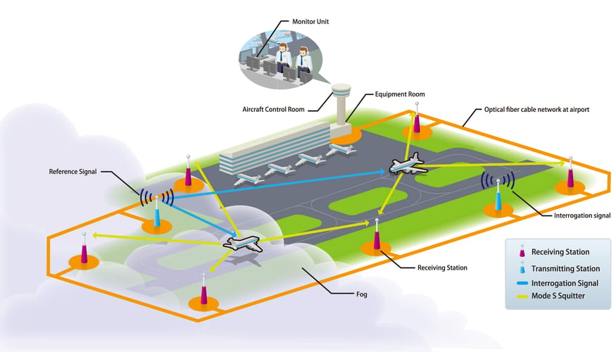
System configuration diagram

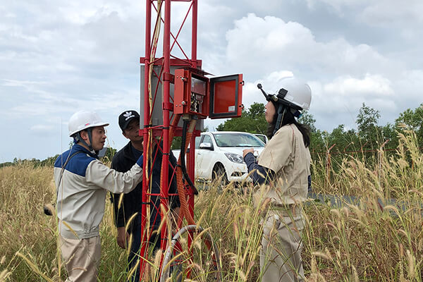
Installation and adjustment

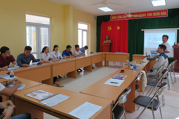
Scene of OJT before delivery

Post-implementation Effects

Safely and efficiently manage airport operations

With implementation of MLAT system, the positioning accuracy is within 3 m at Phu Quoc International Airport, and it is operated with a much higher positioning accuracy than the international standard EUROCAE ED-117A. Even if you cannot see the aircraft at night, you can accurately check the position of the aircraft on the display of MLAT system, which is carefully monitored by flight operators. In response to a rapid increase in the number of flights due to tourism demand, the functions of MLAT system are useful not only for air traffic control of departures and arrivals of aircrafts, but also for safe and efficient management of airport operations.

Interview with Phu Quoc International Airport staff

Implementation Product System

Multilateration system (MLAT)

A multilateration system (MLAT) is a system that surveys the position of an aircraft on the airport surface. Even in situations of poor visibility from the control tower such as at night or in bad weather, the position of the aircraft can be accurately grasped, by MLAT,thus supporting safe and efficient air traffic control services. Furthermore, MLAT system can be applied not only for air traffic control, but also can serve as a sensor for surveying the vicinity of the airport. JRC's MLAT achieves positioning accuracy that exceeds the world standard. In an evaluation at an actual airport, it achieved a positioning accuracy error of 3m on the runway, compared to the standard of 7.5m (ED-117).

Contact Us

Inquiries by web form

Contact Us