- Place of Implementation
-
Tokyo University of Marine Science and Technology,
Faculty of Marine Technology, Department of Maritime Systems Engineering
- Locations
-
Shinagawa (Minato-ku, Tokyo) , Etchujima (Koto-ku, Tokyo)
- University philosophy
-
To engage in basic and applied education and research activities relating to scholarship, science and technology concerned with the ocean, and thereby to contribute to the sustainable development of human society.
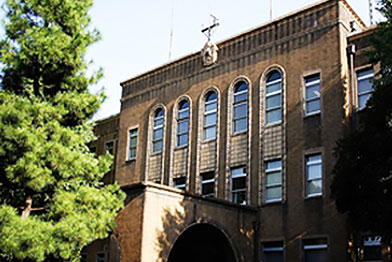
(Etchujima Campus)
While safe navigation is a primary concern in ship operation, there are various other issues as well, such as energy-efficient navigation, environmental protection and anti-piracy measures.
Tokyo University of Marine Science and Technology (TUMSAT) is a center of groundbreaking marine-related education and research that is engaged in advanced studies in ship operation science and technology fields, in search of solutions to the diverse issues facing ships today both in Japan and worldwide.
The university was seeking to develop a new research facility that would support ship operation-related research, development, education and training for the cultivation of the engineer with advanced technologies and researchers who will take the lead in the “ship operation science and technology” field of the future.
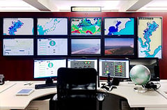
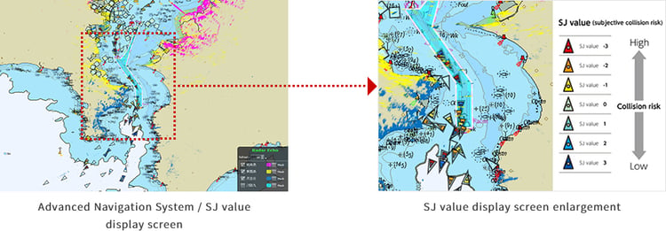
View of Advanced Navigation System
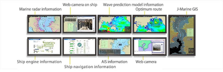
Display Examples on Monitors
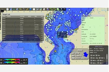
Tokyo Bay AIS information display
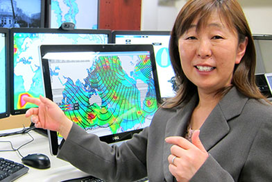
Chair of Department of Maritime Systems Engineering, Faculty of Marine Technology
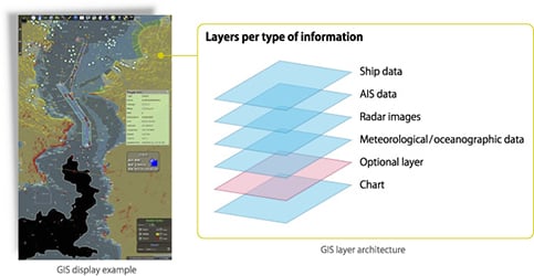
At present, we are working with the Advanced Navigation System to conduct research on collision risk of ships navigating Tokyo Bay, using SJ values applied in real time.
We calculate the SJ values using AIS data location information and ship information gathered by the Advanced Navigation System, and collision risk assessment results are displayed on Advanced Navigation System GIS screen as seven color-coded levels, from +3 (very safe) to -3 (very dangerous). As a result, we are now able to grasp at a glance the level of risk of ships navigating Tokyo Bay.
The greatest advantage of the Advanced Navigation System is that new research and system development can be carried out using the information it gathers and manages, and that those results can then be applied in the Advanced Navigation System.
Overlaying the SJ value layer on the Tokyo Bay real-time ship information layer makes it possible to engage in more practical research.
Contact Us
Inquiries by web form
